Difference between revisions of "Private sidings connected to the Severn Valley Railway"
(add links) |
|||
| Line 34: | Line 34: | ||
*[[Ironbridge power station]] | *[[Ironbridge power station]] | ||
*[[Bower Yard Lime Kilns Siding]] | *[[Bower Yard Lime Kilns Siding]] | ||
| − | *[[Sand Pit siding at Buildwas]] | + | *[[Mr Griffith's Sand Siding at Buildwas]] (accessed via the station exchange sidings) |
| + | *[[Sand Pit siding at Buildwas]] (located opposite Buildwas Abbey) | ||
====Unconfirmed==== | ====Unconfirmed==== | ||
| Line 40: | Line 41: | ||
An 1897 photo from the GRC&W shows a wagon built for E.B.Mason marked with "Return to Sand Quarries, Stourport". The location of the sand quarry and its associated siding are not known, however, a visitor to the SVR in 2022 recalled meeting someone who worked for Masons in the 1930s loading sand into canal boats to be shipped to Stourport where it was transferred to railway wagons.<ref>[https://www.facebook.com/groups/2360466988/posts/10158999000296989/ Discussion on the Unofficial SVR Facebook Group]</ref>. Ordnance Survey maps show sand pits adjacent to the canal north of Stourport from the 1880s to the 1950s. [https://maps.nls.uk/geo/explore/#zoom=15.8&lat=52.35018&lon=-2.27060&layers=168&b=1 Link to map] | An 1897 photo from the GRC&W shows a wagon built for E.B.Mason marked with "Return to Sand Quarries, Stourport". The location of the sand quarry and its associated siding are not known, however, a visitor to the SVR in 2022 recalled meeting someone who worked for Masons in the 1930s loading sand into canal boats to be shipped to Stourport where it was transferred to railway wagons.<ref>[https://www.facebook.com/groups/2360466988/posts/10158999000296989/ Discussion on the Unofficial SVR Facebook Group]</ref>. Ordnance Survey maps show sand pits adjacent to the canal north of Stourport from the 1880s to the 1950s. [https://maps.nls.uk/geo/explore/#zoom=15.8&lat=52.35018&lon=-2.27060&layers=168&b=1 Link to map] | ||
| − | |||
| − | |||
==See also== | ==See also== | ||
Revision as of 15:32, 9 May 2023
As well as the collieries served by the Severn Valley Railway, a number of other businesses had direct rail connections.
- J. P. Harvey's Corn Mill at Kidderminster
- J.H.Smith (Accessed via J.P.Harvey's Corn Mill)
- Summerfield Siding (Accessed via J.P.Harvey's Corn Mill)
- Guiseley Silica's siding at Kidderminster
- General Refractories (Accessed via the Guiseley Silica sidings)
- Wagon Repairs Limited Sidings at Kidderminster
- Thatcher and Whitehouse's Sand Siding at Kidderminster
- H. Whitehouse's Sand Siding at Kidderminster
- Gravel Pit at Foley Park
- Temporary siding for construction of the Sugar Beet Factory at Foley Park (1925)
- Sugar Beet Factory at Foley park
- Smethwick Drop Forgings Ltd. (Accessed via the British Sugar Corporation sidings)
- Colprovia Ltd. (Accessed via the British Sugar Corporation sidings)
- Thomas Vale & Sons (Accessed via the British Sugar Corporation sidings)
- Leapgate Oil Depot
- Hartlebury Brick Works
- Wilden Sand Siding
- Stourport Power Station
- Steatite & Porcelain Products Ltd at Burlish
- National Cold Stores at Stourport
- Temporary siding for construction of the Elan Valley Aqueduct (1899-1906)
- Stone quarry siding opposite Highley Station (1880-1881)
- Knowlesands Brick Works
- Temporary siding for the Shropshire and West Midlands Agricultural Show at Bridgnorth (1896)
- Coalport Brick & Tile Works Siding
- Maw & Co Tile Works at Broseley
- Jackfield Brick & Tile Works
- Doughty and Prestage's Wharf (Accessed via Jackfield Siding)
- Exley's Wharf (Accessed via Jackfield Siding)
- W. P. Jones' Wharf (Accessed via Jackfield Siding)
- Ironbridge power station
- Bower Yard Lime Kilns Siding
- Mr Griffith's Sand Siding at Buildwas (accessed via the station exchange sidings)
- Sand Pit siding at Buildwas (located opposite Buildwas Abbey)
Unconfirmed
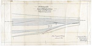
An 1876 GWRGreat Western Railway plan shows a proposed siding for a 'Mr. Green' at Kidderminster, possibly George Ferrer Green, timber dealer and sand merchant.
An 1897 photo from the GRC&WGloucester Railway Carriage and Wagon Company shows a wagon built for E.B.Mason marked with "Return to Sand Quarries, Stourport". The location of the sand quarry and its associated siding are not known, however, a visitor to the SVRSevern Valley Railway in 2022 recalled meeting someone who worked for Masons in the 1930s loading sand into canal boats to be shipped to Stourport where it was transferred to railway wagons.[1]. Ordnance Survey maps show sand pits adjacent to the canal north of Stourport from the 1880s to the 1950s. Link to map
See also
- Collieries served by the Severn Valley Railway
- Businesses located at SVR stations
- List of historical Signal Boxes and Ground Frames
- Pre-1963 Map
