Mr Griffith's Sand Siding at Buildwas
On 10 May 1899 the GWR traffic committee agreed to provide a siding to serve Mr Griffith's sand fields at Buildwas at an estimated cost to him of £138.[1]
-
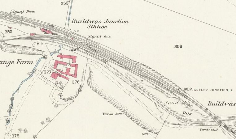 Buildwas station 1882

The extract from the OS 25 inch map of Shropshire above, surveyed in 1882 and published in 1883 shows the layout of Buildwas station before the siding was provided. The station's exchange sidings lay between the station and Abbeygrange Farm and were accessed via the Much Wenlock / Coalbrookdale Branches. One of the sidings continued under the single-track Severn Valley and double-track Coalbrookdale lines (bottom right) to reach a GWR pumping station on the River Severn. The area between that siding and the rest of the station's exchange sidings is described as 'Sand pits'.
-
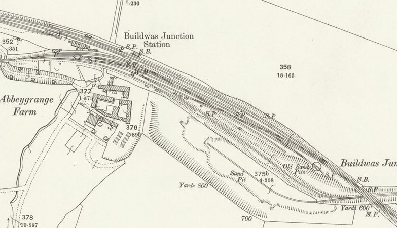 Buildwas station 1901

The extract from the OS 25 inch Map above, revised in 1901 and published in 1902, shows the same area after the siding was provided. The former 'Sand pits' have become 'Old sand pits'. A new sand pit has opened further south, with its own siding accessed via a reversal from the pumping station siding.
-
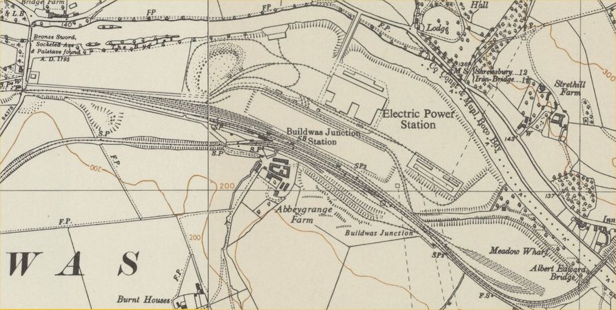 1954 OS map showing the power station and sidings

The final map above is extracted from the 1:10,000 OS Map surveyed in 1954 and shows the layout after Ironbridge power station was built. The pumping station siding is no longer in situ. The sand siding is still present and has been extended, but is now accessed via an extended headshunt.
See also[edit | edit source]
- Private sidings connected to the Severn Valley Railway
- Pre-1963 map
- List of historical Signal Boxes and Ground Frames
References[edit | edit source]
- ↑ Marshall (1989) p. 111.