File:Boundary marker SO743856.jpg
From SVR Wiki
Size of this preview: 754 × 599 pixels. Other resolutions: 302 × 240 pixels | 800 × 636 pixels.
Original file (800 × 636 pixels, file size: 198 KB, MIME type: image/jpeg)
Summary
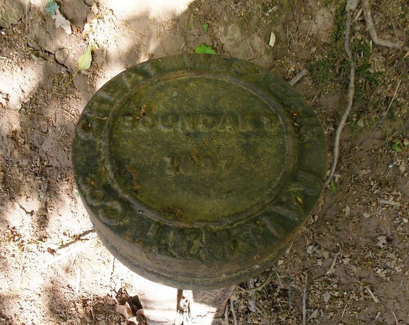
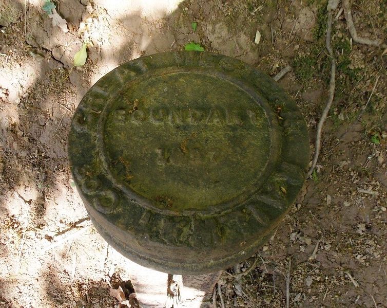
GWR boundary marker approximately 1/2 mile south of Hampton Loade Station, west of railway, near milepost 145.
Licencing
I, the creator of this work, hereby release it into the public domain. This applies worldwide.
In case this is not legally possible,
I grant any entity the right to use this work for any purpose, without any conditions, unless such conditions are required by law.
File history
Click on a date/time to view the file as it appeared at that time.
| Date/Time | Thumbnail | Dimensions | User | Comment | |
|---|---|---|---|---|---|
| current | 10:52, 5 May 2020 | | 800 × 636 (198 KB) | Graham Phillips 110 (talk | contribs) | Boundary marker approximately 1/2 mile south of Hampton Loade Station, west of railway, near milepost 145. |
- You cannot overwrite this file.
File usage
The following 2 pages link to this file: