GWR boundary markers
Jump to navigation
Jump to search
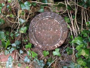
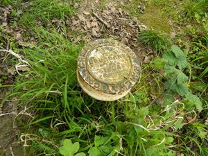
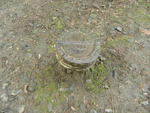
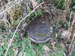
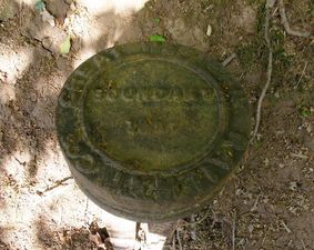
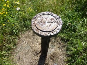
Early railway companies often used boundary markers to show the edge of railway property. GWR boundary markers took the form of round metal plaques, normally with the words GREAT WESTERN RAILWAY COS around the edge and the word BOUNDARY in the centre; the date was also sometimes shown. These would usually be mounted on a short length of old broad-gauge track set into the ground.[1]
A number of original GWR boundary markers on the Severn Valley Branch can still be seen in situ at or near their original locations. Two adjacent to Victoria Bridge are included in the Wyre Forest District Council Local Heritage List.
Worcestershire[edit | edit source]
-
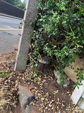 Near Hoo Road Bridge
 -
 South west corner of Falling Sands Viaduct
 -
 South east corner of Sandbourne Viaduct
 -
 River bank south of Victoria Bridge (listed)
 -
 River bank north of Victoria Bridge (listed}
 -
 North west abutment of Victoria Bridge


Shropshire[edit | edit source]
-
 ½ mile south of Hampton Loade, west of railway, near milepost 145
 -
 Near the site of the first Jackfield Halt
 -
 One of two near the middle level crossing at Jackfield sidings
 -
 One of two near the middle level crossing at Jackfield sidings


See also[edit | edit source]
References[edit | edit source]
- ↑ Oxford History (retrieved 25 August 2020)