Difference between revisions of "Staffordshire & Worcestershire Canal"
From SVR Wiki
(add photo) |
m (typo) |
||
| Line 1: | Line 1: | ||
| − | [[File:Viaduct - geograph.org.uk - 499261.jpg|thumb|300px|right| The Staffordshire & Worcestershire Canal at | + | [[File:Viaduct - geograph.org.uk - 499261.jpg|thumb|300px|right| The Staffordshire & Worcestershire Canal at Falling Sands Viaduct]] |
The 46 mile Staffordshire & Worcestershire Canal was completed in 1771, linking the Trent and Mersey Canal at Heywood Junction in Staffordshire with [[Stourport]] in Worcestershire.<ref>[https://en.wikipedia.org/wiki/Staffordshire_and_Worcestershire_Canal The Staffordshire & Worcestershire Canal on Wikipedia]</ref><br> | The 46 mile Staffordshire & Worcestershire Canal was completed in 1771, linking the Trent and Mersey Canal at Heywood Junction in Staffordshire with [[Stourport]] in Worcestershire.<ref>[https://en.wikipedia.org/wiki/Staffordshire_and_Worcestershire_Canal The Staffordshire & Worcestershire Canal on Wikipedia]</ref><br> | ||
Revision as of 17:22, 23 November 2016

The 46 mile Staffordshire & Worcestershire Canal was completed in 1771, linking the Trent and Mersey Canal at Heywood Junction in Staffordshire with Stourport in Worcestershire.[1]
The canal was used for transporting coal to Stourport Power Station which opened in 1927. A branch line from Stourport Station was built in 1940; thereafter coal could be brought in by rail from Alveley and other local collieries.
The canal and the River Stour can be seen from the train as they pass under Falling Sands Viaduct in Kidderminster.
Gallery
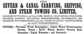
Severn and Canal Carrying, Shipping, and Steam Towing Co. advertisement from 1876