File list
This special page shows all uploaded files.
First page |
Previous page |
Next page |
Last page |
| Date | Name | Thumbnail | Size | User | Description | Versions |
|---|---|---|---|---|---|---|
| 11:04, 7 January 2019 | Archive poster 5.jpg (file) |  |
212 KB | Graham Phillips 110 | 1972 poster for a Grand Bonfire and Fireworks Display at Bridgnorth.<br> Reproduced with permission of SVR(H) | 1 |
| 11:03, 7 January 2019 | Archive poster 4.jpg (file) |  |
209 KB | Graham Phillips 110 | 1969 poster for a Steam Gala at Bridgnorth,<br> Reproduced with permission of SVR(H) | 1 |
| 10:51, 7 January 2019 | Archive poster 3.jpg (file) |  |
149 KB | Graham Phillips 110 | 1969 poster advertisnt a Steam gala at Bridgnorth.<br> Reproduced with permission of SVR(H) | 1 |
| 10:50, 7 January 2019 | Archive poster 2.jpg (file) |  |
178 KB | Graham Phillips 110 | 1967 poster advertising an Open Day at Bridgnorth.<br> Reproduced with permission of SVR(H) | 1 |
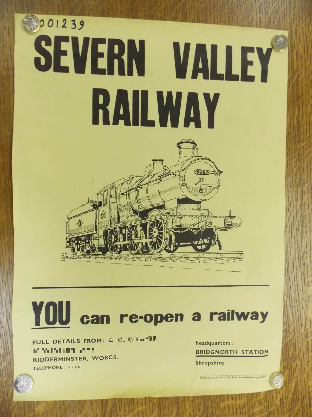
| 10:49, 7 January 2019 | Archive poster 1.jpg (file) |  |
153 KB | Graham Phillips 110 | Poster predating the opening of the SVR.<br> Reproduced with permission of SVR(H)<br> Personal details obscured to comply with the Data Protection Act | 1 |
| 18:28, 1 January 2019 | Bridgnorth 1849 poster.jpg (file) |  |
219 KB | Graham Phillips 110 | 1849 poster advertising a goods conveyancing service between Bridgnorth and the nearest railway station at that time, the Shrewsbury and Birmingham Railway at Wolverhampton.<br> Believed to be copyright expired. Reproduced here for non profit private r... | 1 |
| 17:42, 1 January 2019 | HoE award 2000.jpg (file) |  |
87 KB | Graham Phillips 110 | Heart Of England tourism Awards 2000, Visitor Attraction Of The Year, Highly Commended. | 1 |
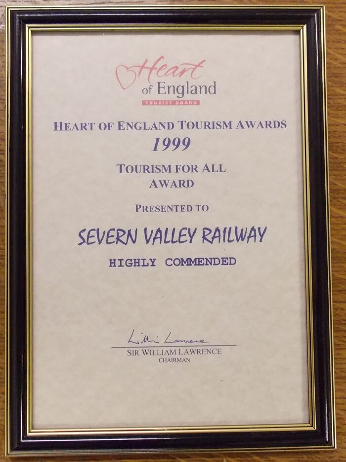
| 17:40, 1 January 2019 | HoE award 1999.jpg (file) |  |
79 KB | Graham Phillips 110 | Heart of England Tourism Awards 1999, Tourism For All Award, Highley Commended. | 1 |
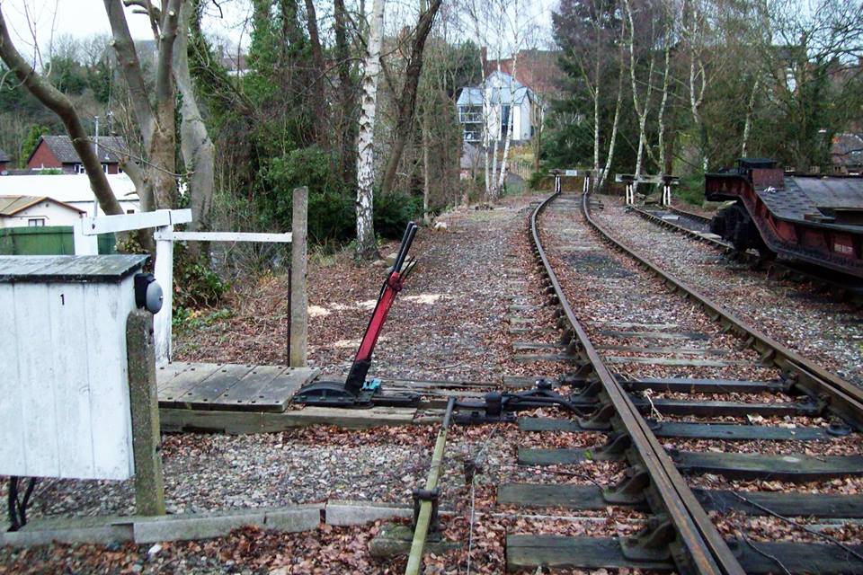
| 19:43, 31 December 2018 | Bridgnorth Boiler Shop Ground Frame.jpg (file) |  |
143 KB | Graham Phillips 110 | Bridgnorth Boiler Shop Ground Frame. Photo: David Cooke | 1 |
| 16:51, 30 December 2018 | Bridgnorth New Building 20181229.jpg (file) |  |
243 KB | Robin | The new station building at Bridgnorth, 29 December 2018 | 1 |
| 16:34, 30 December 2018 | BSC 13 20181229.jpg (file) |  |
219 KB | Robin | Open wagon BSC 13, registration number 16053, stored at Kidderminster Railway Museum following restoration in 2018. | 1 |
| 12:15, 28 December 2018 | SVRleaflet1984back.jpg (file) |  |
98 KB | Graham Phillips 110 | Reverse of SVR leaflet from 1984 advertising the new through route to Kidderminster. ==Licencing== {| class="wikitable" |+Non-free media information and [https://en.wikipedia.org/wiki/Wikipedia:Non-free_use_rationale_guideline use rationale] – non-... | 1 |
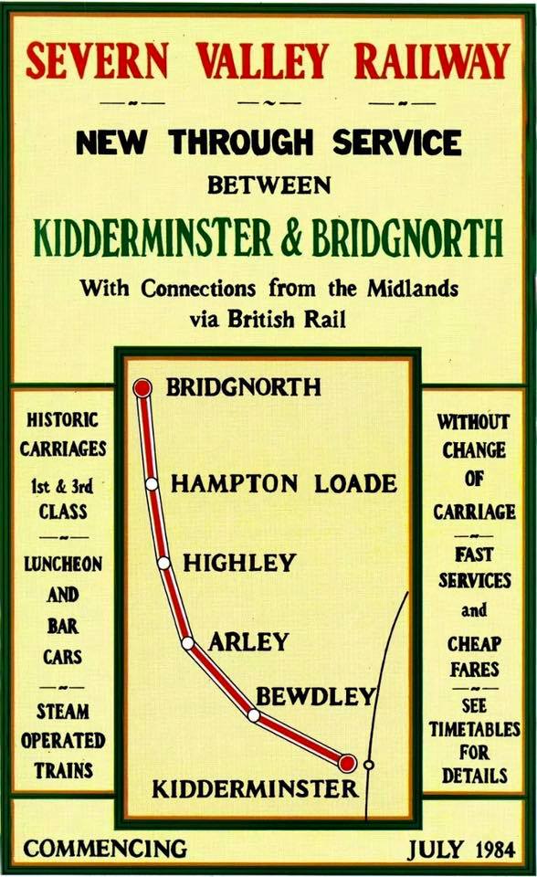
| 12:13, 28 December 2018 | SVRleaflet1984front.jpg (file) |  |
122 KB | Graham Phillips 110 | SVR leaflet from 1984 advertising the new through route to Kidderminster. ==Licencing== {| class="wikitable" |+Non-free media information and [https://en.wikipedia.org/wiki/Wikipedia:Non-free_use_rationale_guideline use rationale] – non-free movie... | 1 |
| 22:18, 26 December 2018 | GWR446.16.01.88.jpg (file) |  |
92 KB | Graham Phillips 110 | GWR Hand Crane 446 in use at Bewdley on 16th January 1988. Photo: Mark Bradshaw | 1 |
| 21:43, 21 December 2018 | BR 707261 Crane Runner.jpg (file) |  |
216 KB | Graham Phillips 110 | BR 707261 Crane Runner at the Stourport Triangle with GWR 446 6Tons 16cwt Hand Crane | 1 |
| 11:27, 20 December 2018 | GWRplanBridgnorth.jpg (file) |  |
493 KB | Graham Phillips 110 | GWR plan of Bridgnorth Station<br> Believed to be copyright expired. Reproduced here for non profit private research purposes. If you have proof that you hold the copyright to this image, please email svrwiki to have it credited or removed at your req... | 1 |
| 11:07, 20 December 2018 | GWRplanBewdley.jpg (file) |  |
215 KB | Graham Phillips 110 | GWR plan of Bewdley Station>br> Believed to be copyright expired. Reproduced here for non profit private research purposes. If you have proof that you hold the copyright to this image, please email svrwiki to have it credited or removed at your request. | 1 |
| 15:37, 10 December 2018 | GWRplanAlveleyHalt.jpg (file) |  |
60 KB | Robin | GWR plan of Alveley Halt<br> Believed to be copyright expired. Reproduced here for non profit private research purposes. If you have proof that you hold the copyright to this image, please email svrwiki to have it credited or removed at your request. | 1 |
| 21:39, 9 December 2018 | GWRplanArley.jpg (file) |  |
77 KB | Graham Phillips 110 | GWR plan of Arley Station<br> Believed to be copyright expired. Reproduced here for non profit private research purposes. If you have proof that you hold the copyright to this image, please email svrwiki to have it credited or removed at your request. | 1 |
| 21:19, 9 December 2018 | Arley token instrument.jpg (file) |  |
83 KB | Graham Phillips 110 | Token instrument at Arley. | 1 |
| 14:58, 7 December 2018 | GWRplanAlveleySidings.jpg (file) |  |
212 KB | Robin | GWR plan showing the layout of Alveley Colliery sidings (coloured red).<br> Believed to be copyright expired. Reproduced here for non profit private research purposes. If you have proof that you hold the copyright to this image, please [[Special:EmailU... | 1 |
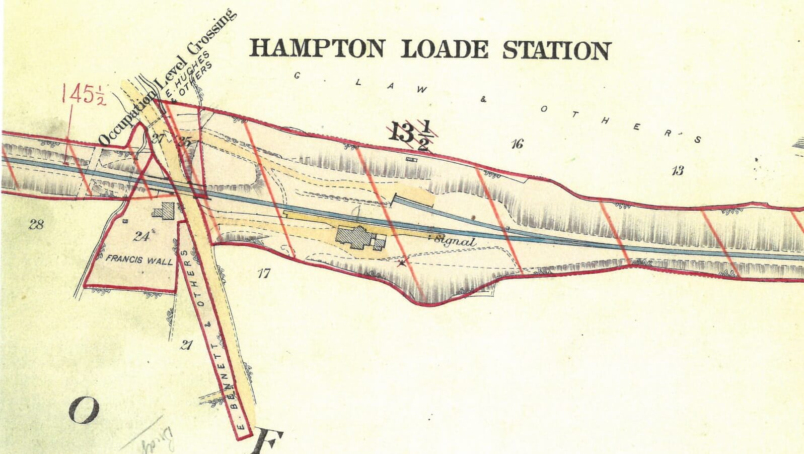
| 10:47, 7 December 2018 | GWRplanHamptonLoade early.jpg (file) |  |
172 KB | Graham Phillips 110 | GWR plan of Hampton Loade Station Believed to be copyright expired. Reproduced here for non profit private research purposes. If you have proof that you hold the copyright to this image, please email svrwiki to have it credited or removed at your request. | 1 |
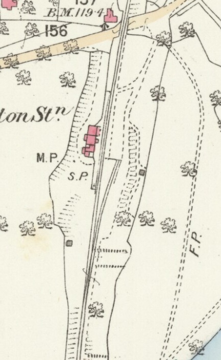
| 10:14, 7 December 2018 | Hampton Loade 1903 map.jpg (file) |  |
175 KB | Graham Phillips 110 | Forgot to crop it | 2 |
| 10:03, 7 December 2018 | GWRplanHamptonLoade.jpg (file) |  |
154 KB | Graham Phillips 110 | GWR plan of Hampton Loade Station<br> Believed to be copyright expired. Reproduced here for non profit private research purposes. If you have proof that you hold the copyright to this image, please email svrwiki to have it credited or removed at your r... | 1 |
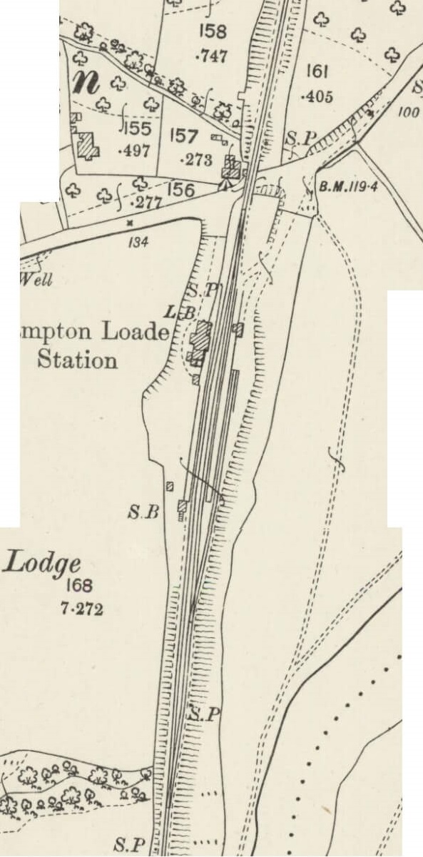
| 09:55, 7 December 2018 | Hampton Loade 1926 map.jpg (file) |  |
150 KB | Graham Phillips 110 | Ordnance Survey 1:2500 map of Hampton Loade published in 1926<br> Reproduced with the permission of the [https://maps.nls.uk/index.html National Library of Scotland] for non-commercial, educational and private purposes under the terms of the [https://c... | 1 |
| 09:29, 7 December 2018 | Hampton Load 1884 map.jpg (file) |  |
99 KB | Graham Phillips 110 | Ordnance Survey 1:2500 map of Hampton Loade published in 1884<br> Reproduced with the permission of the [https://maps.nls.uk/index.html National Library of Scotland] for non-commercial, educational and private purposes under the terms of the [https://c... | 1 |
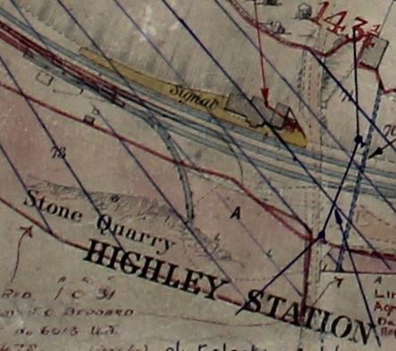
| 16:52, 5 December 2018 | GWRplanHighleyQuarrySiding.jpg (file) |  |
44 KB | Robin | GWR plan showing the Stone Quarry siding at Highley Station provided in 1880<br> Believed to be copyright expired. Reproduced here for non profit private research purposes. If you have proof that you hold the copyright to this image, please [[Special:E... | 1 |
| 16:47, 5 December 2018 | GWRplanHighley.jpg (file) |  |
138 KB | Robin | GWR plan of Highley Station<br> Believed to be copyright expired. Reproduced here for non profit private research purposes. If you have proof that you hold the copyright to this image, please email svrwiki to... | 1 |
| 12:10, 5 December 2018 | GWRplanEardington.jpg (file) |  |
227 KB | Graham Phillips 110 | GWR plan of Eardington Station<br> Believed to be copyright expired. Reproduced here for non profit private research purposes. If you have proof that you hold the copyright to this image, please email svrwiki... | 1 |
| 12:49, 3 December 2018 | Northbridge1.JPG (file) |  |
113 KB | Graham Phillips 110 | Detail view of OO scale model of Northbridge by Warley Model Railway Club.<br> Photo: Duncan Petford | 1 |
| 12:49, 3 December 2018 | Northbridge2.JPG (file) |  |
62 KB | Graham Phillips 110 | Overall view of OO scale model of Northbridge by Warley Model Railway Club.<br> Photo: Duncan Petford | 1 |
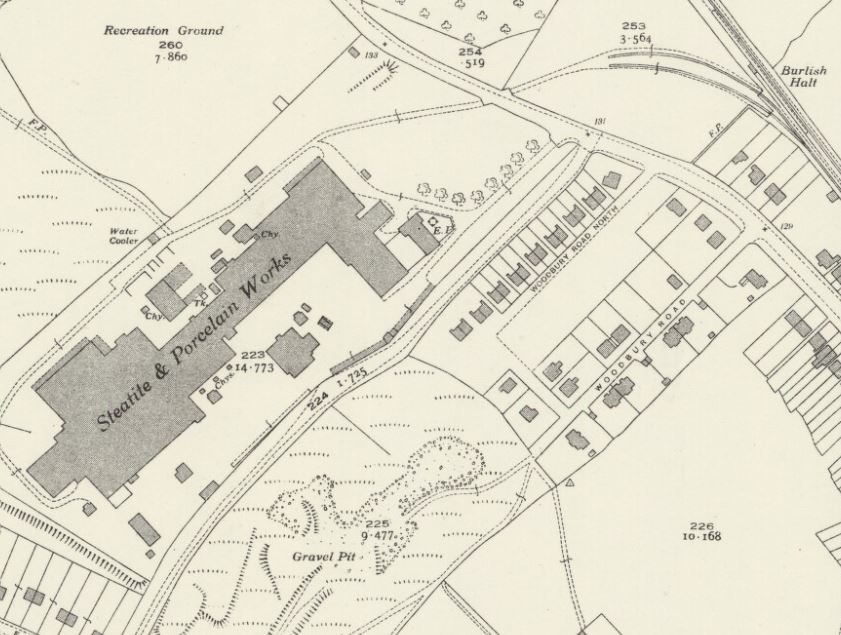
| 15:36, 1 December 2018 | OS Burlish 1939 3.jpg (file) |  |
102 KB | Robin | 1939 OS Map showing the Steatite & Porcelain Products factory and siding. | 1 |
| 15:34, 1 December 2018 | OS Burlish 1939 2.jpg (file) |  |
74 KB | Robin | 1939 OS Map showing the northern end of the Burlish Branch from near the Park Street ground frame (bottom right) to the end of the Steatite & Porcelain Products siding. | 1 |
| 15:31, 1 December 2018 | OS Burlish 1939 1.jpg (file) |  |
70 KB | Robin | 1939 OS Map showing the southern end of the Burlish Branch between Stourport station (bottom right and the Park Street ground frame (top left). | 1 |
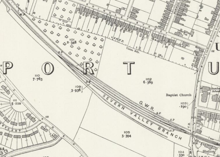
| 15:30, 1 December 2018 | OS Stourport West 1927.jpg (file) |  |
91 KB | Robin | 1927 OS Map showing the layout of sidings west of Stourport. | 1 |
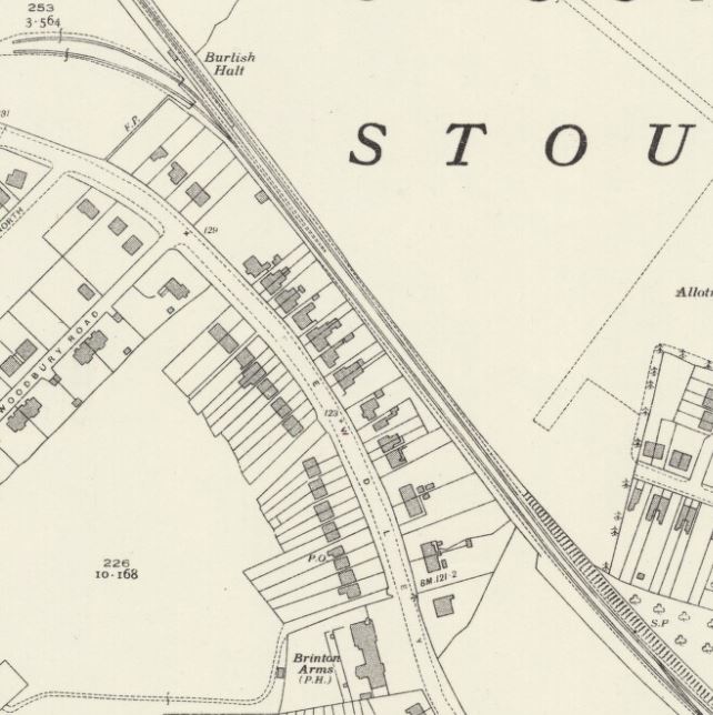
| 23:03, 30 November 2018 | OS Stourport 1951.jpg (file) |  |
58 KB | Robin | 1951 OS Map showing Stourport Station (bottom right) to Burlish Halt (top left). The large building west of the Station to the north of the line is the National Cold Stores which was served by a siding from 1941 onwards. | 1 |
| 22:39, 30 November 2018 | GWRplanFoleyPark2.jpg (file) |  |
129 KB | Graham Phillips 110 | GWR plan of Foley Park with the original single track line in blue and the sand sidings and sugar beet sidings as later amendments in red.<br> Believed to be copyright expired. Reproduced here for non profit private research purposes. If you have proof... | 1 |
| 22:26, 30 November 2018 | GWRplanFoleyPark.jpg (file) |  |
76 KB | Graham Phillips 110 | GWR plan of Foley Park with the original single track line in blue and the halt and sugar beet sidings as later amendments in red.<br> Believed to be copyright expired. Reproduced here for non profit private research purposes. If you have proof that yo... | 1 |
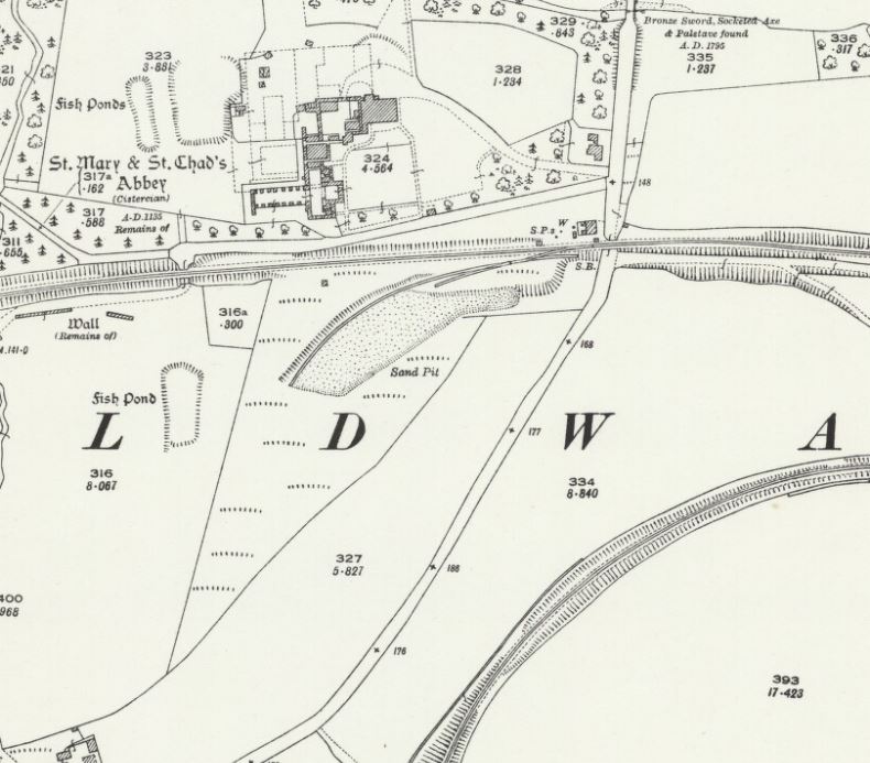
| 16:23, 30 November 2018 | OS Buildwas 1927.jpg (file) |  |
88 KB | Robin | 1927 OS Map of Buildwas showing a Sand Pit siding opposite Buildwas Abbey. | 1 |
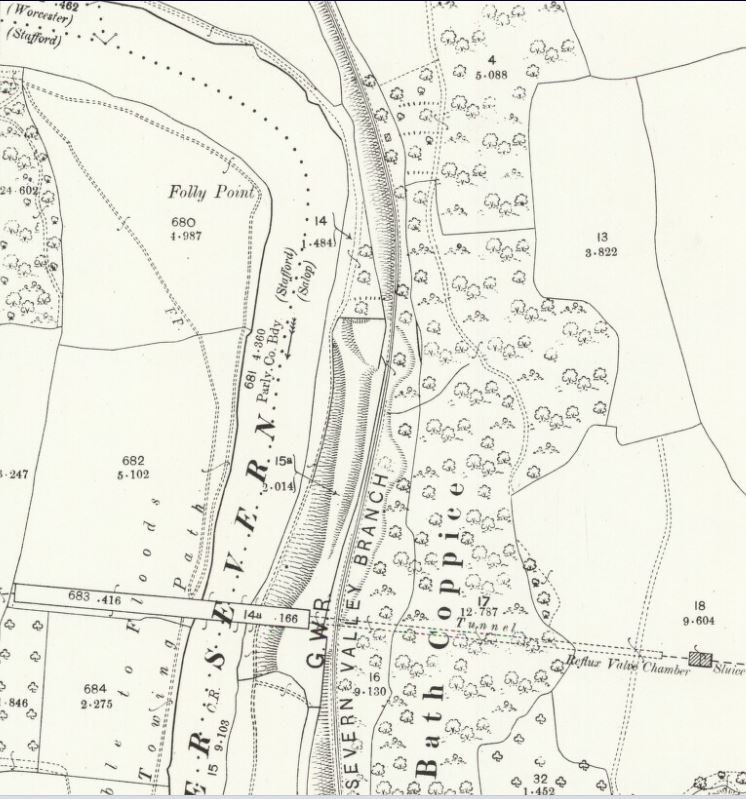
| 15:53, 30 November 2018 | OS Folly Point 1901.JPG (file) |  |
110 KB | Robin | OS Map of Worcestershire 1901 showing Folly Point and the Elan Valley Aqueduct. A temporary siding for use by contractors was in place at this time but was not shown on this version of the OS map. | 1 |
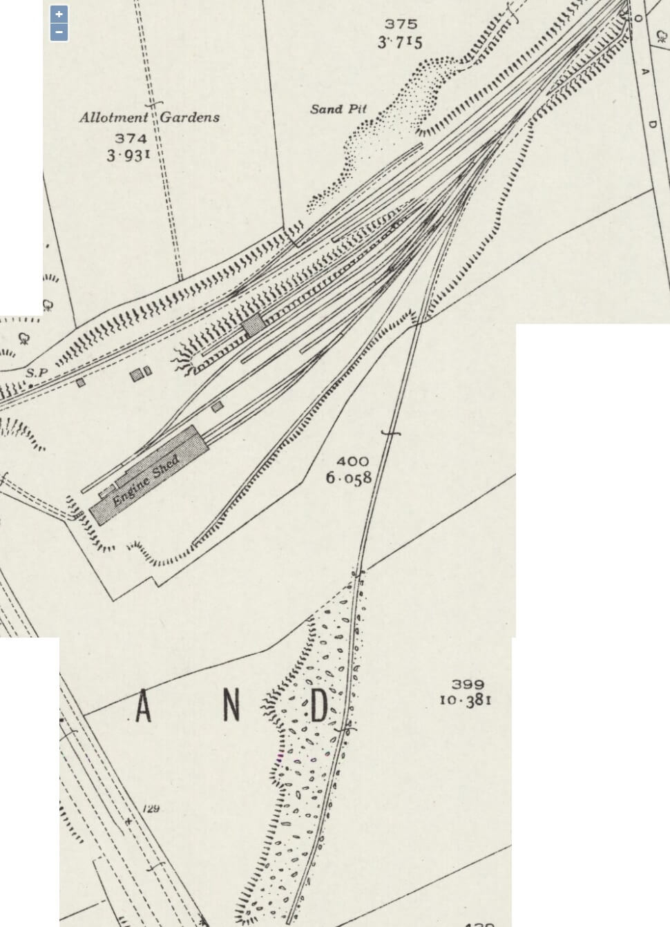
| 15:36, 30 November 2018 | GWRplanKidderminsterEngineShed.jpg (file) |  |
241 KB | Graham Phillips 110 | GWR plan of Kidderminster Engine Shed<br> Believed to be copyright expired. Reproduced here for non profit private research purposes. If you have proof that you hold the copyright to this image, please [[Special:EmailUser/Graham_Phillips_110| email svr... | 1 |
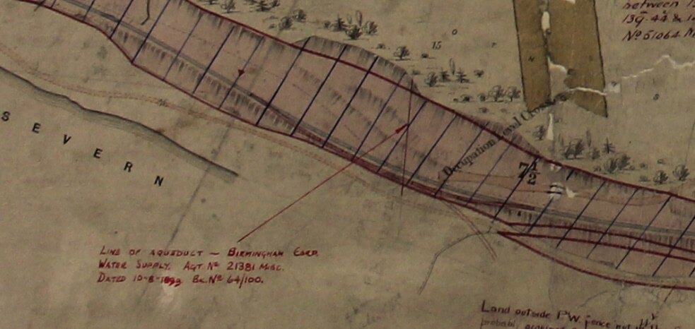
| 15:18, 30 November 2018 | GWRplanFollyPoint.jpg (file) |  |
94 KB | Graham Phillips 110 | GWR plan of the siding at Folly Point<br> Believed to be copyright expired. Reproduced here for non profit private research purposes. If you have proof that you hold the copyright to this image, please [[Special:EmailUser/Graham_Phillips_110| email svr... | 1 |
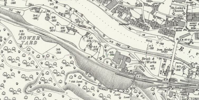
| 16:59, 24 November 2018 | OS Bower Yard 1927.jpg (file) |  |
96 KB | Robin | 1927 OS Map of Ironbridge showing Bower Yard Siding to the south of the line (top left). Ironbridge Station is to the bottom right. | 1 |
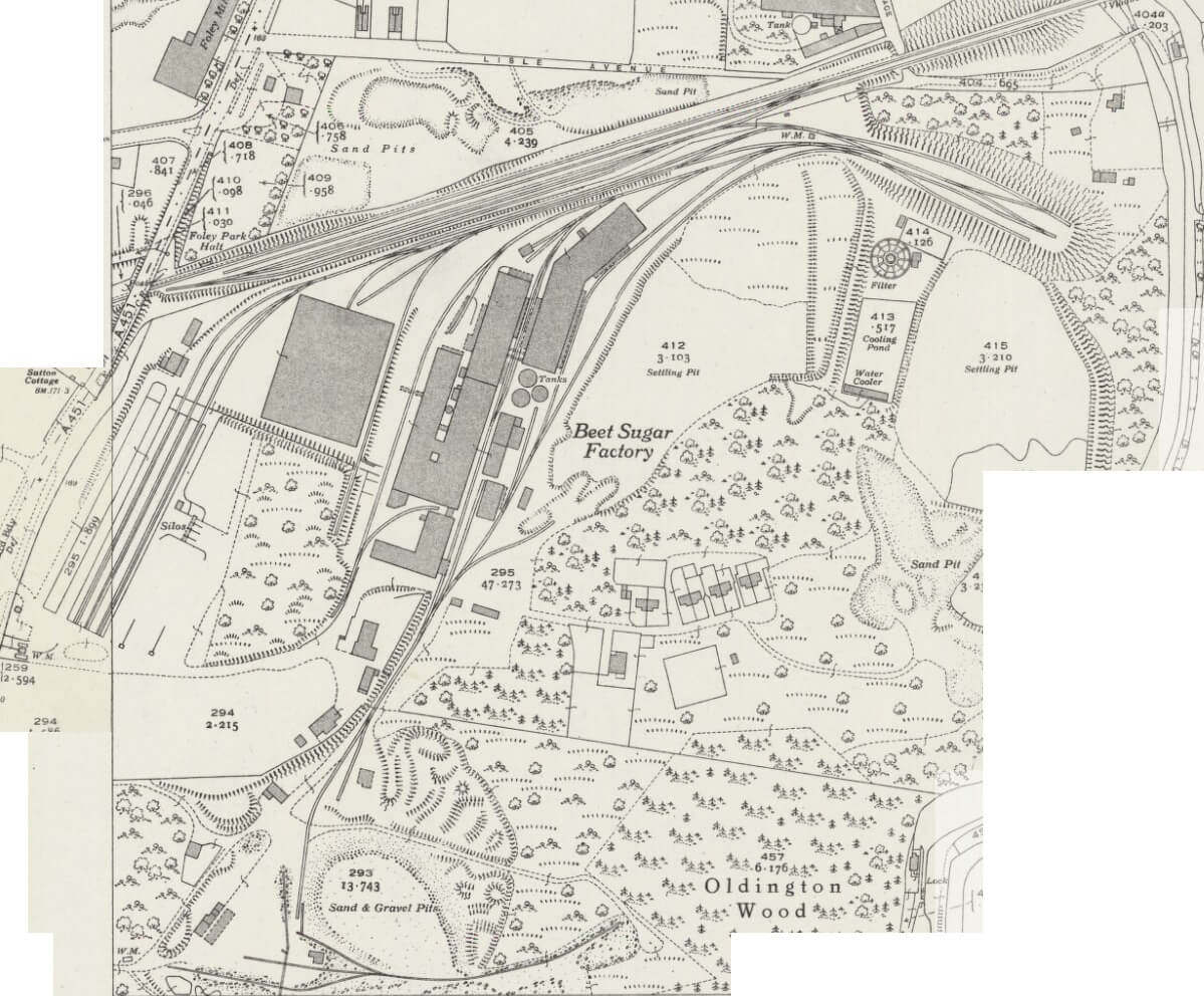
| 21:44, 23 November 2018 | FoleyPark1902map.jpg (file) |  |
85 KB | Graham Phillips 110 | Ordnance Survey 1:2500 map of Foley Park published in 1902<br> Reproduced with the permission of the [https://maps.nls.uk/index.html National Library of Scotland] for non-commercial, educational and private purposes under the terms of the [https://crea... | 1 |
| 21:44, 23 November 2018 | FoleyPark1927map.jpg (file) |  |
219 KB | Graham Phillips 110 | Ordnance Survey 1:2500 map of Foley Park published in 1927<br> Reproduced with the permission of the [https://maps.nls.uk/index.html National Library of Scotland] for non-commercial, educational and private purposes under the terms of the [https://crea... | 1 |
| 21:44, 23 November 2018 | FoleyPark1938map.jpg (file) |  |
171 KB | Graham Phillips 110 | Ordnance Survey 1:2500 map of Foley Park published in 1938<br> Reproduced with the permission of the [https://maps.nls.uk/index.html National Library of Scotland] for non-commercial, educational and private purposes under the terms of the [https://crea... | 1 |
| 20:51, 23 November 2018 | Kidderminstershed1927map.jpg (file) |  |
87 KB | Graham Phillips 110 | Ordnance Survey 1:2500 map of the site of Kidderminster Engine Shed published in 1927<br> Reproduced with the permission of the [https://maps.nls.uk/index.html National Library of Scotland] for non-commercial, educational and private purposes under the... | 1 |
| 20:51, 23 November 2018 | Kidderminstershed1938map.jpg (file) |  |
123 KB | Graham Phillips 110 | Ordnance Survey 1:2500 map of Kidderminster Engine Shed published in 1938<br> Reproduced with the permission of the [https://maps.nls.uk/index.html National Library of Scotland] for non-commercial, educational and private purposes under the terms of th... | 1 |
| 22:16, 20 November 2018 | Bridgnorth turntable planning application 11.18.png (file) |  |
213 KB | Patrick Hearn | Proposed revised turntable location, planning application November 2018 (David Symonds Associates) | 1 |
| 15:54, 5 November 2018 | OS Cound 1961.jpg (file) |  |
113 KB | Robin | OS Map of 1961 showing the location of Cound Halt. Cressage (shown) lay approximately 1.4 miles to the south east, Berrington approximately 2.6 miles to the north west. | 1 |
First page |
Previous page |
Next page |
Last page |