Difference between revisions of "Farm crossing north of milepost 145"
From SVR Wiki
m (Correct link) |
(add pictures and additional info) |
||
| Line 1: | Line 1: | ||
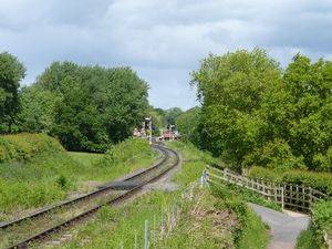
| − | A farm crossing to the | + | [[File: Crossing_13_20150528.jpg|thumb|300px|right| Farm crossing north of milepost 145, looking north]] |
| + | A farm crossing to the south of [[Hampton Loade]]. [[National Cycle Route 45]], which forms a public footpath adjacent to this crossing, is a popular locations for photographers, giving a long distance view into Hampton Loade station. | ||
==See also== | ==See also== | ||
Revision as of 15:40, 13 June 2015
A farm crossing to the south of Hampton Loade. National Cycle Route 45, which forms a public footpath adjacent to this crossing, is a popular locations for photographers, giving a long distance view into Hampton Loade station.
See also
Towards Kidderminster
List of infrastructure
Towards Bridgnorth
