Difference between revisions of "Leapgate Private Sidings"
(correct mileage. Add references) |
(add info and reference) |
||
| Line 3: | Line 3: | ||
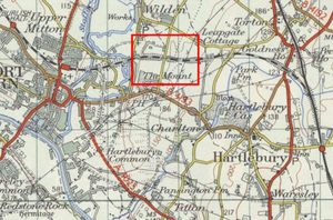
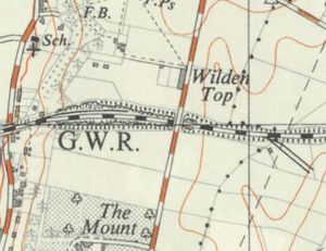
The Leapgate Private Sidings were situated between Hartlebury and Stourport at 133m 53ch<ref name="SA1960">Birmingham Traffic District Sectional Appendix 1960</ref>. They served a depot of the Regent Oil Company (named Texaco after 1967) which opened on 28 August 1939. The depot had no road connection and was probably connected to the Government Pipeline Storage System, a secret fuel supply network created during the Second World War which included a branch running from Ellesmere Port to Avonmouth via Stourport.<ref>[https://www.historic-uk.com/HistoryUK/HistoryofBritain/The-Government-Pipelines-Storage-System-GPSS/ GPSS on historic-uk.com]</ref><ref>[https://en.wikipedia.org/wiki/CLH_Pipeline_System CLH Pipeline (Formerly GPSS) on Wikipedia]</ref> | The Leapgate Private Sidings were situated between Hartlebury and Stourport at 133m 53ch<ref name="SA1960">Birmingham Traffic District Sectional Appendix 1960</ref>. They served a depot of the Regent Oil Company (named Texaco after 1967) which opened on 28 August 1939. The depot had no road connection and was probably connected to the Government Pipeline Storage System, a secret fuel supply network created during the Second World War which included a branch running from Ellesmere Port to Avonmouth via Stourport.<ref>[https://www.historic-uk.com/HistoryUK/HistoryofBritain/The-Government-Pipelines-Storage-System-GPSS/ GPSS on historic-uk.com]</ref><ref>[https://en.wikipedia.org/wiki/CLH_Pipeline_System CLH Pipeline (Formerly GPSS) on Wikipedia]</ref> | ||
| − | The two sidings, one on each side of a gantry, would each hold up to 13 20-ton or 17 10-ton tank wagons. Access to the sidings was controlled by a 2-lever ground frame operating the points and a facing point lock, released by the electric token for the Hartlebury to Stourport section. | + | The two sidings, one on each side of a gantry, would each hold up to 13 20-ton or 17 10-ton tank wagons. Access to the sidings was controlled by a 2-lever ground frame operating the points and a facing point lock, released by the electric token for the Hartlebury to Stourport section. The siding could be accessed either by Down trains or by trains of up to 30 wagons being propelled from Stourport.<ref name="SA1960"/><ref>[[Bibliography#Books|Marshall (1989)]] p. 87.</ref>. |
==See also== | ==See also== | ||
Revision as of 21:19, 30 October 2021
The Leapgate Private Sidings were situated between Hartlebury and Stourport at 133m 53ch[1]. They served a depot of the Regent Oil Company (named Texaco after 1967) which opened on 28 August 1939. The depot had no road connection and was probably connected to the Government Pipeline Storage System, a secret fuel supply network created during the Second World War which included a branch running from Ellesmere Port to Avonmouth via Stourport.[2][3]
The two sidings, one on each side of a gantry, would each hold up to 13 20-ton or 17 10-ton tank wagons. Access to the sidings was controlled by a 2-lever ground frame operating the points and a facing point lock, released by the electric token for the Hartlebury to Stourport section. The siding could be accessed either by DownIn reference to the direction of travel means away from the major terminus (i.e. towards Bridgnorth on the present day SVR) trains or by trains of up to 30 wagons being propelled from Stourport.[1][4].
See also
- Private sidings connected to the Severn Valley Railway
- Pre-1963 map
- List of historical Signal Boxes and Ground Frames
References
- ↑ 1.0 1.1 Birmingham Traffic District Sectional Appendix 1960
- ↑ GPSS on historic-uk.com
- ↑ CLH Pipeline (Formerly GPSS) on Wikipedia
- ↑ Marshall (1989) p. 87.

