File:OS Wilden Detail.jpg
From SVR Wiki
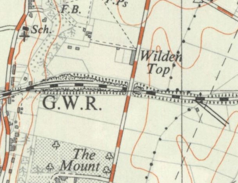
Revision as of 14:55, 23 August 2018 by Robin (talk | contribs) (OS Map of the Wilden area between Hartlebury to Stourport published in 1951. Leapgate Private Sidings were south of the line to the east, with a Sand Siding north of the line to the west.)
Size of this preview: 779 × 600 pixels. Other resolutions: 312 × 240 pixels | 800 × 616 pixels.
Original file (800 × 616 pixels, file size: 194 KB, MIME type: image/jpeg)
Summary
OSOrdnance Survey Map of the Wilden area between Hartlebury to Stourport published in 1951. Leapgate Private Sidings were south of the line to the east, with a Sand Siding north of the line to the west.
Licencing
This image is derived from an original Ordnance Survey Map held on the National Library of Scotland Map Images Website.
Reproduced with the permission of the National Library of Scotland under the terms of the Creative Commons Attribution-NonCommercial-ShareAlike (CC-BY-NC-SA) licence.
File history
Click on a date/time to view the file as it appeared at that time.
| Date/Time | Thumbnail | Dimensions | User | Comment | |
|---|---|---|---|---|---|
| current | 14:55, 23 August 2018 | | 800 × 616 (194 KB) | Robin (talk | contribs) | OS Map of the Wilden area between Hartlebury to Stourport published in 1951. Leapgate Private Sidings were south of the line to the east, with a Sand Siding north of the line to the west. |
- You cannot overwrite this file.
File usage
The following 3 pages link to this file: