Difference between revisions of "File:OS Map Alveley Crossing.JPG"
From SVR Wiki
(Extract from the 1905 OS map, showing the route of the Highley to Alveley footpath via Potters Load ferry) |
(Licencing) |
||
| Line 2: | Line 2: | ||
Extract from the 1905 OS map, showing the route of the Highley to Alveley footpath via Potters Load ferry | Extract from the 1905 OS map, showing the route of the Highley to Alveley footpath via Potters Load ferry | ||
== Licencing == | == Licencing == | ||
| − | {{ | + | {{National Library of Scotland OS Map}} |
Latest revision as of 11:09, 10 July 2016
Summary
Extract from the 1905 OSOrdnance Survey map, showing the route of the Highley to Alveley footpath via Potters Load ferry
Licencing
This image is derived from an original Ordnance Survey Map held on the National Library of Scotland Map Images Website.
Reproduced with the permission of the National Library of Scotland under the terms of the Creative Commons Attribution-NonCommercial-ShareAlike (CC-BY-NC-SA) licence.
File history
Click on a date/time to view the file as it appeared at that time.
| Date/Time | Thumbnail | Dimensions | User | Comment | |
|---|---|---|---|---|---|
| current | 15:35, 4 December 2015 | 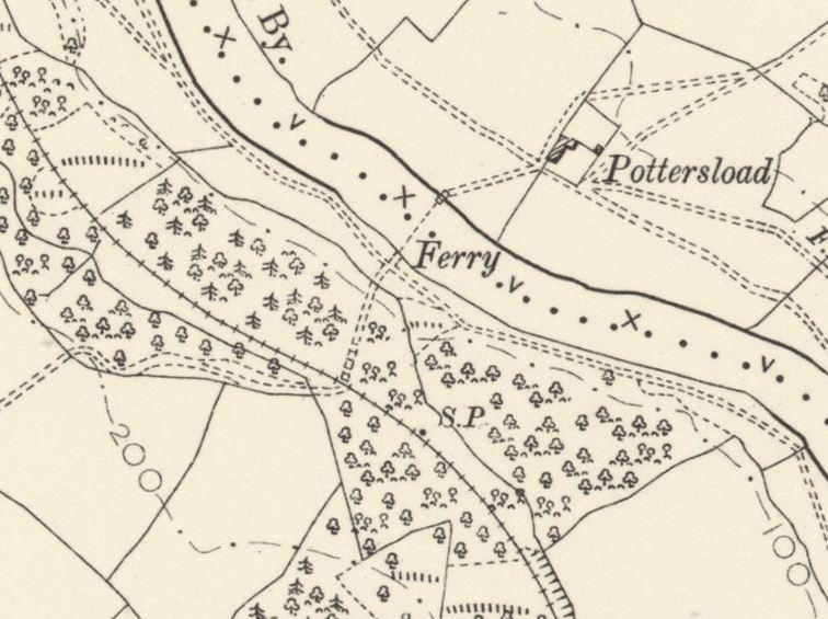 | 756 × 565 (86 KB) | Robin (talk | contribs) | Extract from the 1905 OS map, showing the route of the Highley to Alveley footpath via Potters Load ferry |
- You cannot overwrite this file.
File usage
The following page links to this file: