File:OS Burlish 1939 2.jpg
Size of this preview: 598 × 600 pixels. Other resolutions: 239 × 240 pixels | 642 × 644 pixels.
Original file (642 × 644 pixels, file size: 74 KB, MIME type: image/jpeg)
Summary
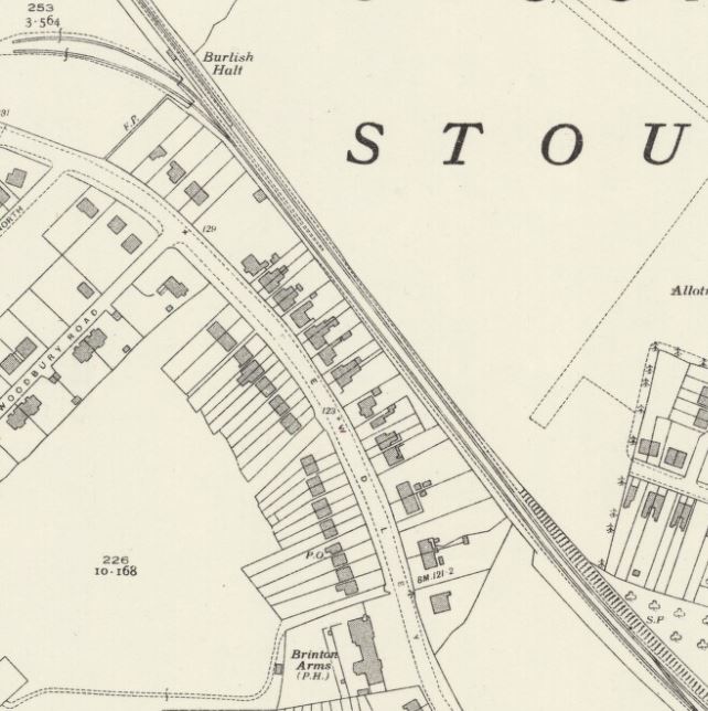
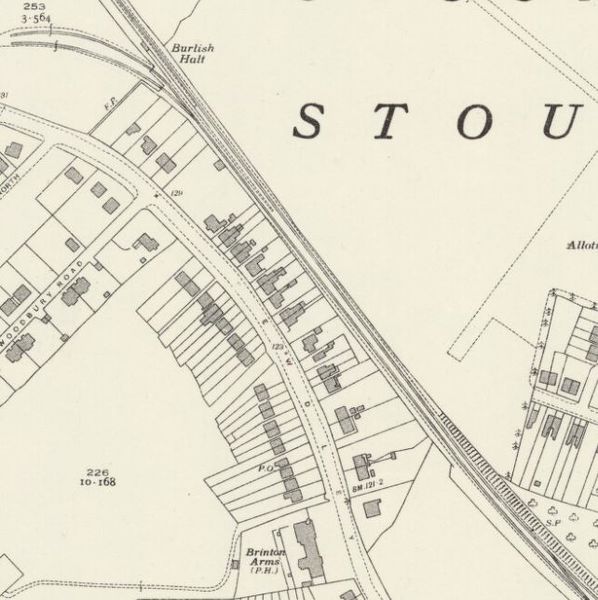
1939 OS Map showing the northern end of the Burlish Branch from near the Park Street ground frame (bottom right) to the end of the Steatite & Porcelain Products siding.
Licencing
This image is derived from an original Ordnance Survey Map held on the National Library of Scotland Map Images Website.
Reproduced with the permission of the National Library of Scotland under the terms of the Creative Commons Attribution-NonCommercial-ShareAlike (CC-BY-NC-SA) licence.
File history
Click on a date/time to view the file as it appeared at that time.
| Date/Time | Thumbnail | Dimensions | User | Comment | |
|---|---|---|---|---|---|
| current | 15:34, 1 December 2018 | | 642 × 644 (74 KB) | Robin (talk | contribs) | 1939 OS Map showing the northern end of the Burlish Branch from near the Park Street ground frame (bottom right) to the end of the Steatite & Porcelain Products siding. |
- You cannot overwrite this file.
File usage
The following page links to this file: