Difference between revisions of "File:Highley Collieries OS Map.jpg"
From SVR Wiki
(Robin uploaded a new version of File:Highley Collieries OS Map.jpg) |
(Licencing) |
||
| Line 1: | Line 1: | ||
Extract from the Ordnance Survey Map of 1937-1961 showing location of collieries near Highley (Crown Copyright reserved) | Extract from the Ordnance Survey Map of 1937-1961 showing location of collieries near Highley (Crown Copyright reserved) | ||
| + | |||
| + | ==Licencing== | ||
| + | {{National Library of Scotland OS Map}} | ||
Latest revision as of 11:20, 10 July 2016
Extract from the Ordnance Survey Map of 1937-1961 showing location of collieries near Highley (Crown Copyright reserved)
Licencing
This image is derived from an original Ordnance Survey Map held on the National Library of Scotland Map Images Website.
Reproduced with the permission of the National Library of Scotland under the terms of the Creative Commons Attribution-NonCommercial-ShareAlike (CC-BY-NC-SA) licence.
File history
Click on a date/time to view the file as it appeared at that time.
| Date/Time | Thumbnail | Dimensions | User | Comment | |
|---|---|---|---|---|---|
| current | 21:04, 1 July 2015 | 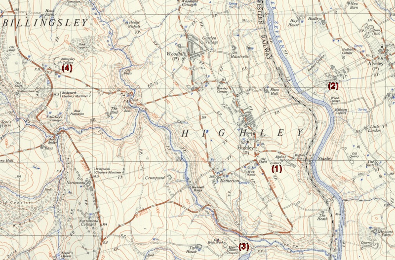 | 800 × 527 (248 KB) | Robin (talk | contribs) | Extract from the Ordnance Survey Map of 1937-1961 showing location of collieries near Highley. |
- You cannot overwrite this file.
File usage
The following file is a duplicate of this file (more details):
There are no pages that link to this file.