File:OS Hartlebury South 1883.jpg
Jump to navigation
Jump to search

Size of this preview: 420 × 600 pixels. Other resolution: 530 × 757 pixels.
Original file (530 × 757 pixels, file size: 89 KB, MIME type: image/jpeg)
Summary[edit | edit source]
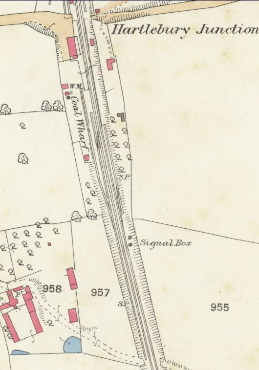
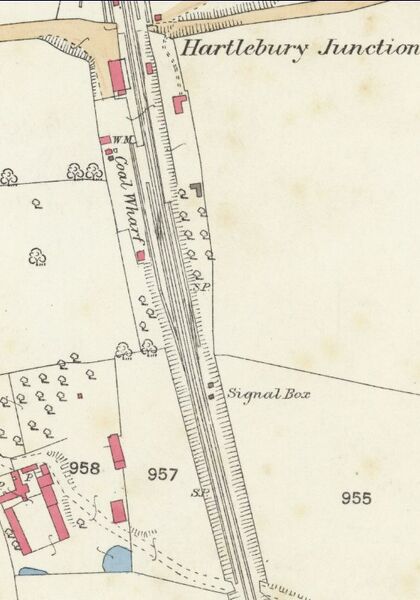
OS 25in map of 1883 showing Hartlebury Station and the area to the south.
Licencing[edit | edit source]
This image is derived from an original Ordnance Survey Map held on the National Library of Scotland Map Images Website.
Reproduced with the permission of the National Library of Scotland under the terms of the Creative Commons Attribution-NonCommercial-ShareAlike (CC-BY-NC-SA) licence.
File history
Click on a date/time to view the file as it appeared at that time.
| Date/Time | Thumbnail | Dimensions | User | Comment | |
|---|---|---|---|---|---|
| current | 13:00, 20 January 2025 | | 530 × 757 (89 KB) | Robin (talk | contribs) | OS 25in map of 1883 showing Hartlebury Station and the area to the south. |
You cannot overwrite this file.
File usage
The following page uses this file: