File:OS Bower Yard 1927.jpg
No higher resolution available.
OS_Bower_Yard_1927.jpg (754 × 381 pixels, file size: 96 KB, MIME type: image/jpeg)
Summary
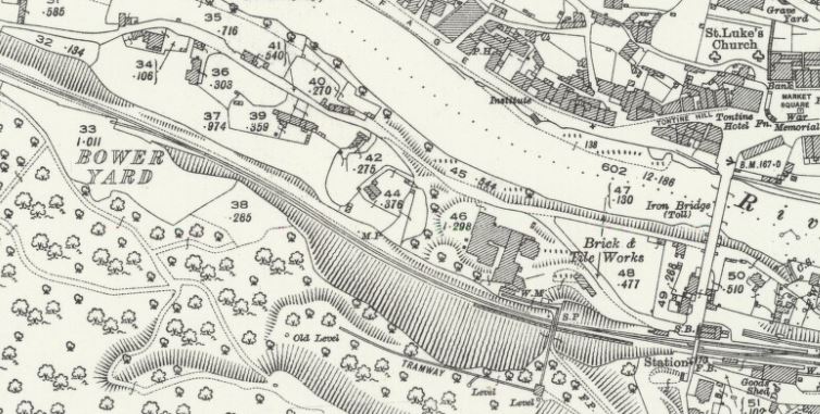
1927 OS Map of Ironbridge showing Bower Yard Siding to the south of the line (top left). Ironbridge Station is to the bottom right.
Licencing
This image is derived from an original Ordnance Survey Map held on the National Library of Scotland Map Images Website.
Reproduced with the permission of the National Library of Scotland under the terms of the Creative Commons Attribution-NonCommercial-ShareAlike (CC-BY-NC-SA) licence.
File history
Click on a date/time to view the file as it appeared at that time.
| Date/Time | Thumbnail | Dimensions | User | Comment | |
|---|---|---|---|---|---|
| current | 16:59, 24 November 2018 | | 754 × 381 (96 KB) | Robin (talk | contribs) | 1927 OS Map of Ironbridge showing Bower Yard Siding to the south of the line (top left). Ironbridge Station is to the bottom right. |
- You cannot overwrite this file.
File usage
The following page links to this file: