File:OS Sutton Bridge Junction 1927.jpg
Summary
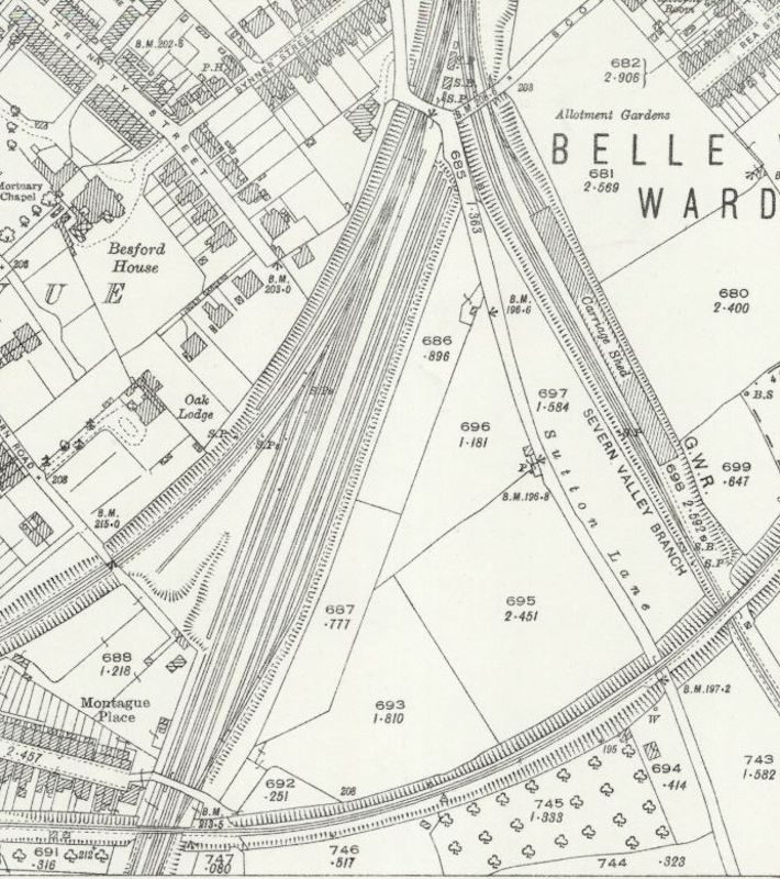
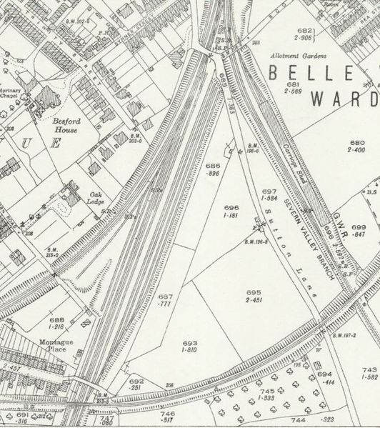
Extract from the OS 25 in map of Shropshire XXXIV.11 (Atcham; Shrewsbury), revised: 1925, published: 1927, showing the area south of Sutton Bridge Junction Signal Box with the routes of the Cambrian line to the south west, the Shrewsbury & Hereford line to the south and the Severn Valley Branch to the south east. The box was situated immediately north of the road bridge at the top of the map, in the fork between the Severn Valley Branch and the other lines.
Licencing
This image is derived from an original Ordnance Survey Map held on the National Library of Scotland Map Images Website.
Reproduced with the permission of the National Library of Scotland under the terms of the Creative Commons Attribution-NonCommercial-ShareAlike (CC-BY-NC-SA) licence.
File history
Click on a date/time to view the file as it appeared at that time.
| Date/Time | Thumbnail | Dimensions | User | Comment | |
|---|---|---|---|---|---|
| current | 14:08, 10 May 2021 | | 710 × 800 (167 KB) | Robin (talk | contribs) | Extract from the OS 25 in map of Shropshire XXXIV.11 (Atcham; Shrewsbury), revised: 1925, published: 1927, showing the area south of Sutton Bridge Junction Signal Box with the routes of the Cambrian line to the south west, the Shrewsbury & Hereford lin... |
- You cannot overwrite this file.
File usage
The following page links to this file: