Rock Siding


The Rock Siding is a double-ended siding at Bewdley, situated on the north east side of the station, opposite platform 3[1].
Contents
Construction
At the time the Severn Valley Railway was being built, both the Tenbury and Bewdley Railway and Kidderminster Loop Line had also been authorised and so Bewdley was planned as a junction station. The local geography meant that although the north and south approaches to the station would both need viaducts, the station itself required considerable excavation to create a sufficiently large level area. This resulted in a sandstone rockface along the north east side of the station.
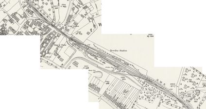
The view below shows Bewdley circa 1890 (after the opening of the Loop Line in 1878) with a train standing at Platform 2. Platform 3 is to the right of the island platform as seen; the land further to the right of it was levelled as part of the original excavation but had not been developed further since. This layout is reflected in the extract from the 1882 OS map.

Bewdley circa 1890
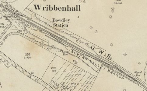
OS map of Bewdley in 1882


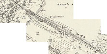
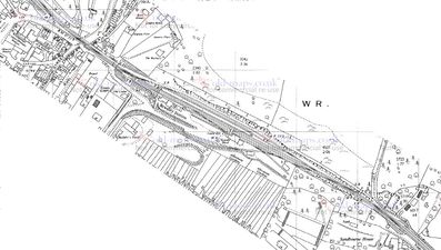
On 9 August 1900, the GWR authorised the provision of additional siding space at Bewdley at a cost of £2,051. This included the 'Rock Siding' between platform 3 and the rock face (from which the siding takes its name) and also a new siding along the far side of Bewdley Down Yard.[2] The first picture below showing a large P Way gang at Bewdley is dated to circa 1900 and therefore may be associated with the Rock Siding construction work. The second picture shows a similar view in 1910 to that in 1890 above, but with the Rock Siding present. Both new sidings can be seen on the revised 1901 OS map.

P Way gang at Bewdley circa 1900
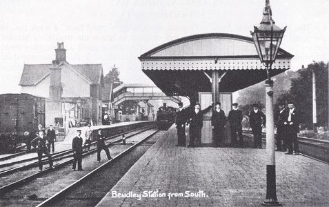
Bewdley in 1910

OS map of Bewdley in 1901


Operations
While Bewdley station platforms 1 to 3 are signalled between the North and South signal boxes, Rock Siding is operated as a through siding.
The south end of the siding is used for servicing steam locomotives as Bewdley MPD, whilst the north end is usually used to store the Class 108 DMU when not in use, although the DMU is occasionally temporarily stationed elsewhere during special events to clear the siding, such as the Spring and Autumn Galas.
Other historic maps of Bewdley
- GWR plan of Bewdley station with the original lines in blue and the Rock Siding and alterations to the Down Yard as later amendments in red.
- 1903 map showing facing and trailing crossovers, the Rock siding and an additional siding in the goods yard.
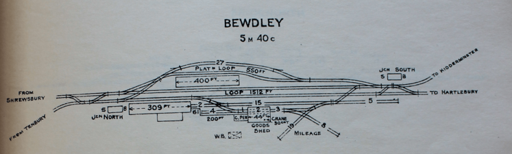
- 1905 GWR schematic plan of Bewdley giving siding capacities and other details.
- 1927 map showing the longer platform and canopy and changes to the southern access to the Back Road and Rock Siding.
- 1964 map showing showing changes to the southern access to the Back Road and the goods yard.
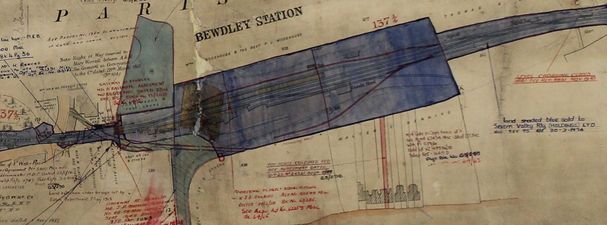
GWR plan
1903
1905
1927
1964


See also
References
Links
- 46512 in the Rock Siding in 1972. David Cooke collection.
- 75069 passes Bewdley South signal box on 20 April 1986. David Rostance. Note the disc signal for the Rock Siding, since replaced by a signal arm.