Little Rock Cutting
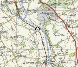
Little Rock Cutting is a small cutting situated just over a mile north of Hampton Loade Station. Its location is highlighted on the extract from the 1955-61 OS Map. The cutting is included on the map in the SVR's From The Window booklet but is shown at a location nearer Waterworks Crossing.
There is no public access to the cutting,[1] although from time to time it has appeared in photographs taken by SVR-accredited lineside photographers.
References
- ↑ Shropshire Council Definitive Map (retrieved 6 April 2018)
