File:Mapandlinks.png
Revision as of 20:30, 9 June 2017 by Graham Phillips 110 (talk | contribs) (Scematic map of the line)

Size of this preview: 348 × 599 pixels. Other resolutions: 139 × 240 pixels | 401 × 690 pixels.
Original file (401 × 690 pixels, file size: 43 KB, MIME type: image/png)
Summary
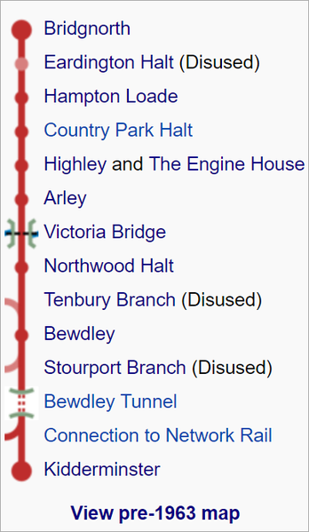
Scematic map of the line
Licencing
I, the creator of this work, hereby release it into the public domain. This applies worldwide.
In case this is not legally possible,
I grant any entity the right to use this work for any purpose, without any conditions, unless such conditions are required by law.
File history
Click on a date/time to view the file as it appeared at that time.
| Date/Time | Thumbnail | Dimensions | User | Comment | |
|---|---|---|---|---|---|
| current | 20:30, 9 June 2017 | | 401 × 690 (43 KB) | Graham Phillips 110 (talk | contribs) | Scematic map of the line |
- You cannot overwrite this file.
File usage
The following 2 pages link to this file: