File:Bridgnorth1884map.jpg
Size of this preview: 656 × 600 pixels. Other resolutions: 263 × 240 pixels | 1,257 × 1,149 pixels.
Original file (1,257 × 1,149 pixels, file size: 238 KB, MIME type: image/jpeg)
Summary
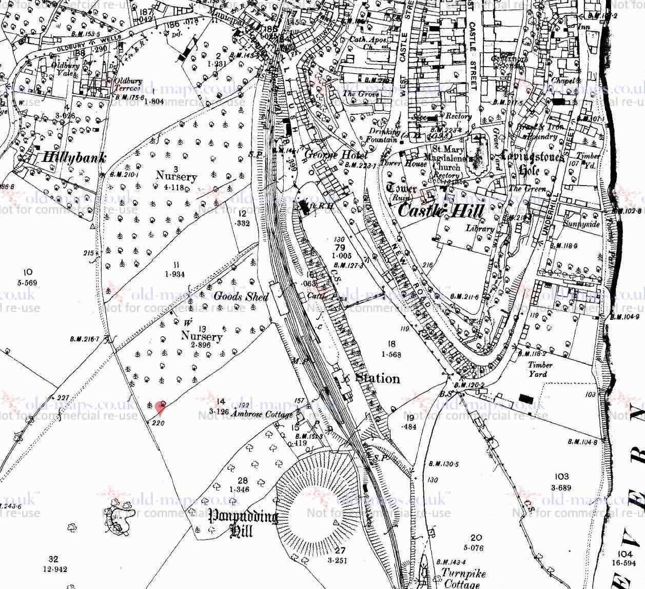
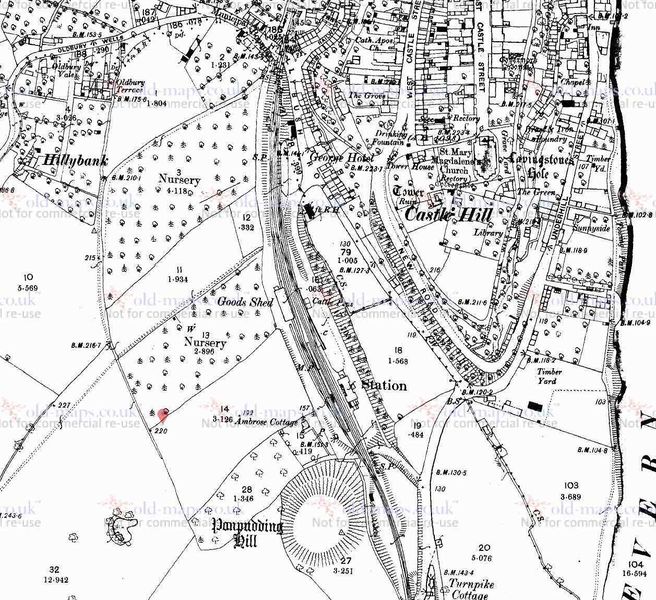
1884 Ordnance Survey map of Bridgnorth Station
Copyright held by Ordnance Survey and Old-Maps.co.uk
Reproduced by permission of Old-Maps.co.uk for non-commercial purposes
See www.ordnancesurvey.co.uk and www.old-maps.co.uk for full copyright details.
Licencing
The copyright holder has given permission for use of this image on the SVR Wiki.
It may not be used for any other purpose without explicit permission from the copyright holder.
If possible, this image should be replaced by one using a free license.
File history
Click on a date/time to view the file as it appeared at that time.
| Date/Time | Thumbnail | Dimensions | User | Comment | |
|---|---|---|---|---|---|
| current | 15:54, 30 October 2018 | | 1,257 × 1,149 (238 KB) | Graham Phillips 110 (talk | contribs) | 1884 Ordnance Survey map of Bridgnorth Station<br> Copyright held by Ordnance Survey and Old-Maps.co.uk<br> Reproduced by permission of Old-Maps.co.uk for non-commercial purposes<br> See [www.ordnancesurvey.co.uk] and [www.old-maps.co.uk] for full copy... |
- You cannot overwrite this file.
File usage
The following page links to this file: