Difference between revisions of "Farm crossing north of milepost 145"
From SVR Wiki
(add pictures and additional info) |
m (Info added) |
||
| Line 6: | Line 6: | ||
[[List of infrastructure]]<br> | [[List of infrastructure]]<br> | ||
[[Underbridge at Hampton Loade | Towards Bridgnorth]] | [[Underbridge at Hampton Loade | Towards Bridgnorth]] | ||
| + | |||
| + | ==Link== | ||
| + | [https://www.google.co.uk/maps/place/Hampton+Loade,+Bridgnorth+WV15+6HD/@52.4702015,-2.3783952,176m/data=!3m1!1e3!4m5!3m4!1s0x48708825c134f0a9:0xbcbef8be5ce9ac9d!8m2!3d52.4769!4d-2.3741119|Google map 52.470186, -2.377835]<br> | ||
| + | [https://osmaps.ordnancesurvey.co.uk/52.46833,-2.37770,18 OS Grid SO 74438 85665] | ||
Latest revision as of 13:19, 4 August 2018
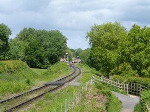
A farm crossing to the south of Hampton Loade. National Cycle Route 45, which forms a public footpath adjacent to this crossing, is a popular locations for photographers, giving a long distance view into Hampton Loade station.
See also
Towards Kidderminster
List of infrastructure
Towards Bridgnorth
