Difference between revisions of "Dropping Well Farm"
(Added directions/GPS as a trial, towards building a photographic guide.) |
(add directions) |
||
| Line 5: | Line 5: | ||
==Access for photography== | ==Access for photography== | ||
| − | The location is accessed via the B4195 out of Bewdley towards the A456. A right turn will lead you to a small car park, which has good access to the length of line. Once parked, cross the road and follow the lane in the Kidderminster direction (sign posted as a cycle way). Staying on the right side of the railway, you reach Bewdley 'Airport'. A gallery of photographers can sometimes be seen at the top of the field for views of trains on the SVR | + | The location is accessed via the B4195 out of Bewdley towards the A456. A right turn immediately after the pedestrian crossing, before the roundabout, will lead you to a small car park, which has good access to the length of line. Once parked, cross the road and follow the lane in the Kidderminster direction (sign posted as a cycle way). Staying on the right side of the railway, you reach Bewdley 'Airport'. A gallery of photographers can sometimes be seen at the top of the field for views of trains on the SVR |
| − | + | ====Directions==== | |
| − | [https:// | + | The nearest Postcode for Satnav directions is DY12 1PU<br> |
| + | Lat. & Long. coordinates; 52.367587, -2.282182 [https://goo.gl/maps/ZXRiRjEQWt92 View location on Google Maps] <br> | ||
| + | Ordnance Survey Grid Reference; SO 806744 [https://binged.it/2BSRfTS View location on an OS map] | ||
==See also== | ==See also== | ||
[[From The Window]] | [[From The Window]] | ||
Revision as of 10:26, 12 February 2018
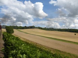
Bewdley International Airport is the ‘tongue-in-cheek’ nickname of the private landing strip which can be seen in the field on the left of the line after leaving Bewdley Tunnel travelling towards Bewdley. Two small hangars and a windsock are located at the end of the field nearest Bewdley.
The 'Airport' is opposite The Devil's Spittleful.
Access for photography
The location is accessed via the B4195 out of Bewdley towards the A456. A right turn immediately after the pedestrian crossing, before the roundabout, will lead you to a small car park, which has good access to the length of line. Once parked, cross the road and follow the lane in the Kidderminster direction (sign posted as a cycle way). Staying on the right side of the railway, you reach Bewdley 'Airport'. A gallery of photographers can sometimes be seen at the top of the field for views of trains on the SVRSevern Valley Railway
Directions
The nearest Postcode for Satnav directions is DY12 1PU
Lat. & Long. coordinates; 52.367587, -2.282182 View location on Google Maps
Ordnance Survey Grid Reference; SO 806744 View location on an OS map
