Dropping Well Farm lies south of the railway between Bewdley Tunnel and Bewdley on the former Kidderminster Loop Line. It is situated opposite The Devil's Spittleful a short way east of the area now known as "Safari Park curve". The field next to the line is commonly used by photographers and was formerly home to a small private airstrip.
Dropping Well Farm is operated by a private company, J & W.E. Willets Ltd.[1] The farm is also sometimes referred to as Droppingwells Farm, while old Ordnance Survey maps also showed the name as "Droppingwell Farm".
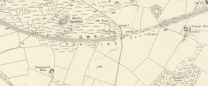
1903 OS Map of the Loop Line including 'Droppingwell Farm'

Contents
Worcestershire Wildlife Trust
95 acres at Dropping Well Farm were purchased by the Esmee Fairbairn Foundation through their Land Purchase Fund on behalf of the Worcestershire Wildlife Trust (WWT), with the intention to restore heathland and connect with The Devil's Spittleful and Blackstone Farm Fields nature reserves and Wyre Forest District Council's Rifle Range and Burlish Top nature reserves.[2]
The J & W.E. Willets Ltd. accounts for the period ending 31 December 2019 show a reduction in fixed assets from £698,349 to £241,627, recognising both the sale and the continued operation of the remainder of the farm business.
WWT's long-term plan to restore the heathland includes the provision of a circular trail with notice boards giving information on the land management and wildlife. New fencing will allow the land to be grazed to help boost the wildlife species.[3]
The surrounding field had also become noted for its display of red poppies, which require tilled soil to germinate and thrive. It is expected that the return to heathland will diminish these fine displays.
Bewdley International Airport
Bewdley International Airport was the 'tongue-in-cheek' nickname of the private landing strip (ICAO code XEG3DW) in the field on the left of the line after leaving Bewdley Tunnel travelling towards Bewdley. Two small hangars and a windsock were located at the end of the field nearest Bewdley. The grass strip was always left intact when the field was ploughed. By April 2021 the grass strip that had always been left intact had been ploughed out.
The runway at Bewdley International Airport in 2015

The same view in April 2021

The hangars seen from the railway in 2016


Access for photography
Although new fencing has been erected in 2022, access is still possible to the area at the top of the field next to the railway line near Bewdley Tunnel where a gallery of photographers can sometimes be seen.
Dropping Well Farm may be accessed via the B4195 out of Bewdley towards the A456. A right turn immediately after the pedestrian crossing, before the roundabout leads to the small car park of the Blackstone Picnic Site. Once parked, cross the road and follow the lane in the Kidderminster direction (sign posted as a cycle way). After passing below the underbridge of the old Stourport Branch, follow the track to the left. When a fork is reached, bear left towards the Devil's Spittleful (Rifle Range) Bridge (there is no longer any public access from the track to the right which leads to the 'hangars' and the farm itself). Just before the bridge is a large gate and small pedestrian gate on the right. An area about 30 yards wide adjacent to the line is still accessible. Another gate next to the signal allows access to the top of the field for 'long distance' views of the line. The walk from the car park to the top of the field takes around 20 minutes.
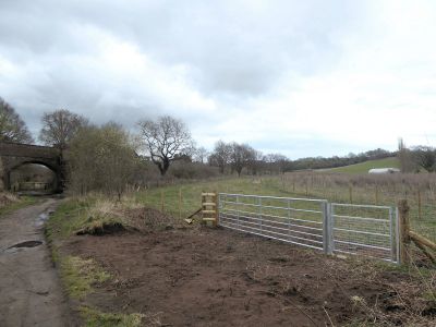
New fencing and access gate (2022). Rifle Range Bridge is to the left.

For those preferring to reach the top of the field from Gould Avenue and the Burlish Top Nature Reserve, access is still possible via another small pedestrian gate in the new fence, although the path leading down to it is not maintained and as of April 2022[update] is obstructed by a fallen tree.
Directions
Dropping Well Farm, Stourport Road, Bewdley, Worcestershire, DY12 1PZ
The nearest Postcode for Satnav directions is DY12 1PU
Lat. & Long. coordinates; 52.367587, -2.282182 View location on Google Maps
Ordnance Survey Grid Reference; SO 806744 View location on an OS map
Gallery
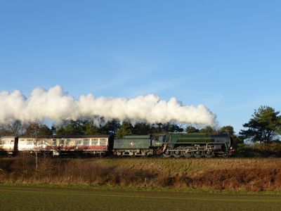
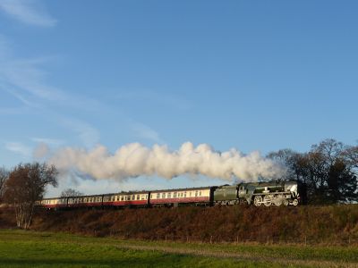
Photos taken at Dropping Well Farm:

GNR 1744 (2012 Spring Gala)
60019 Bittern (2012 Spring Gala)
92214 (2014 Santa services)
34027 Taw Valley (2016 Santa services)
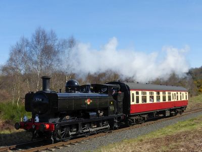
7714 (2017 Footplate Experience)


See also
References
- ↑ J & W.E. Willets Ltd. On Companies House
- ↑ 'Plans to create 'largest heathland habitat' in Worcestershire, BBC, 21 October 2020 (Retrieved 22 October 2020)
- ↑ WWT notices on display at the site in April 2022