File:OWW map.jpg
From SVR Wiki

Size of this preview: 800 × 334 pixels. Other resolutions: 320 × 133 pixels | 1,283 × 535 pixels.
Original file (1,283 × 535 pixels, file size: 212 KB, MIME type: image/jpeg)
Summary
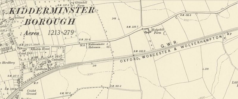
1905 Ordnance Survey map showing railway marked as "GWRGreat Western Railway Oxford, Worcester & Wolverhampton".
Map from National Library of Scotland reproduced here for non-commercial, educational and private purposes.
Licencing
This work has been (or is hereby) released into the public domain by the copyright holder. This applies worldwide.
In case this is not legally possible,
The copyright holder grants any entity the right to use this work for any purpose, without any conditions, unless such conditions are required by law.
File history
Click on a date/time to view the file as it appeared at that time.
| Date/Time | Thumbnail | Dimensions | User | Comment | |
|---|---|---|---|---|---|
| current | 10:37, 6 May 2016 | | 1,283 × 535 (212 KB) | Graham Phillips 110 (talk | contribs) | 1905 Ordnance Survey map showing railway marked as "GWR Oxford, Worcester & Wolverhampton". Map from [http://maps.nls.uk/geo/explore/print.cfm#zoom=15&lat=52.3945&lon=-2.2204&layers=171 National Library of Scotland] reproduced here for non-commercial,... |
- You cannot overwrite this file.
File usage
The following page links to this file: