File:OS Stourport 1951.jpg
From SVR Wiki
No higher resolution available.
OS_Stourport_1951.jpg (543 × 446 pixels, file size: 58 KB, MIME type: image/jpeg)
Summary
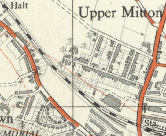
1951 OSOrdnance Survey Map showing Stourport Station (bottom right) to Burlish Halt (top left). The large building west of the Station to the north of the line is the National Cold Stores which was served by a siding from 1941 onwards.
Licencing
This image is derived from an original Ordnance Survey Map held on the National Library of Scotland Map Images Website.
Reproduced with the permission of the National Library of Scotland under the terms of the Creative Commons Attribution-NonCommercial-ShareAlike (CC-BY-NC-SA) licence.
File history
Click on a date/time to view the file as it appeared at that time.
| Date/Time | Thumbnail | Dimensions | User | Comment | |
|---|---|---|---|---|---|
| current | 23:03, 30 November 2018 | | 543 × 446 (58 KB) | Robin (talk | contribs) | 1951 OS Map showing Stourport Station (bottom right) to Burlish Halt (top left). The large building west of the Station to the north of the line is the National Cold Stores which was served by a siding from 1941 onwards. |
- You cannot overwrite this file.
File usage
The following page links to this file: