File:Kidderminster station, 1963 - 3387931.jpg
From SVR Wiki
Size of this preview: 800 × 428 pixels. Other resolutions: 320 × 171 pixels | 2,354 × 1,260 pixels.
Original file (2,354 × 1,260 pixels, file size: 3.34 MB, MIME type: image/jpeg)
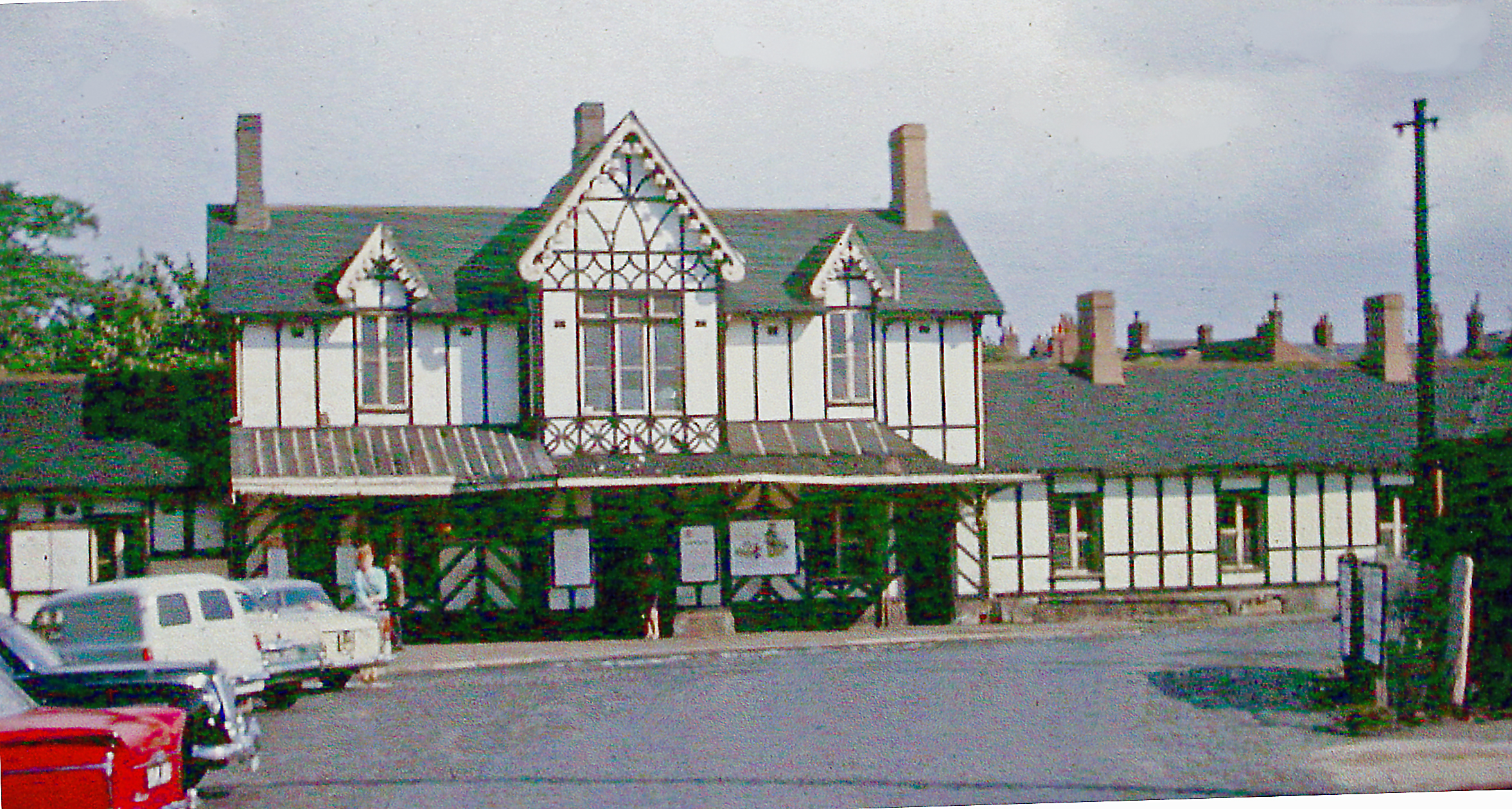
| Description | View eastward of the main entrance, which is on the Down side: ex-GWR (London etc.) - Worcester - Wolverhampton/Birmingham main line. This is the original, unusual mock-Tudor building of 1852, which was demolished due to dry-rot in 1968 and rebuilt in conventional form. | ||
| Date | |||
| Source | Geograph project | ||
| Author | Ben Brooksbank | ||
| Permission (Reusing this file) |
This file is licensed under the Creative Commons Attribution-Share Alike 2.0 Generic licence. Attribution: Ben Brooksbank
|
||
| Attribution (required by the licence) | Ben Brooksbank / Kidderminster station, 1963 / | ||

| Camera location | | View this and other nearby images on: OpenStreetMap |
|---|
_heading:90.00&language=en-gb)
| Object location | | View this and other nearby images on: OpenStreetMap |
|---|
_heading:90.00&language=en-gb)
File history
Click on a date/time to view the file as it appeared at that time.
| Date/Time | Thumbnail | Dimensions | User | Comment | |
|---|---|---|---|---|---|
| current | 19:01, 31 March 2013 | | 2,354 × 1,260 (3.34 MB) | G-13114 | {{Information |Description= View eastward of the main entrance, which is on the Down side: ex-GWR (London etc.) - Worcester - Wolverhampton/Birmingham main line. This is the original, unusual mock-Tudor building of 1852, which was demolished due to dry... |
File usage
The following page links to this file: