File:Bridgnorth tunnel map.jpg
Summary
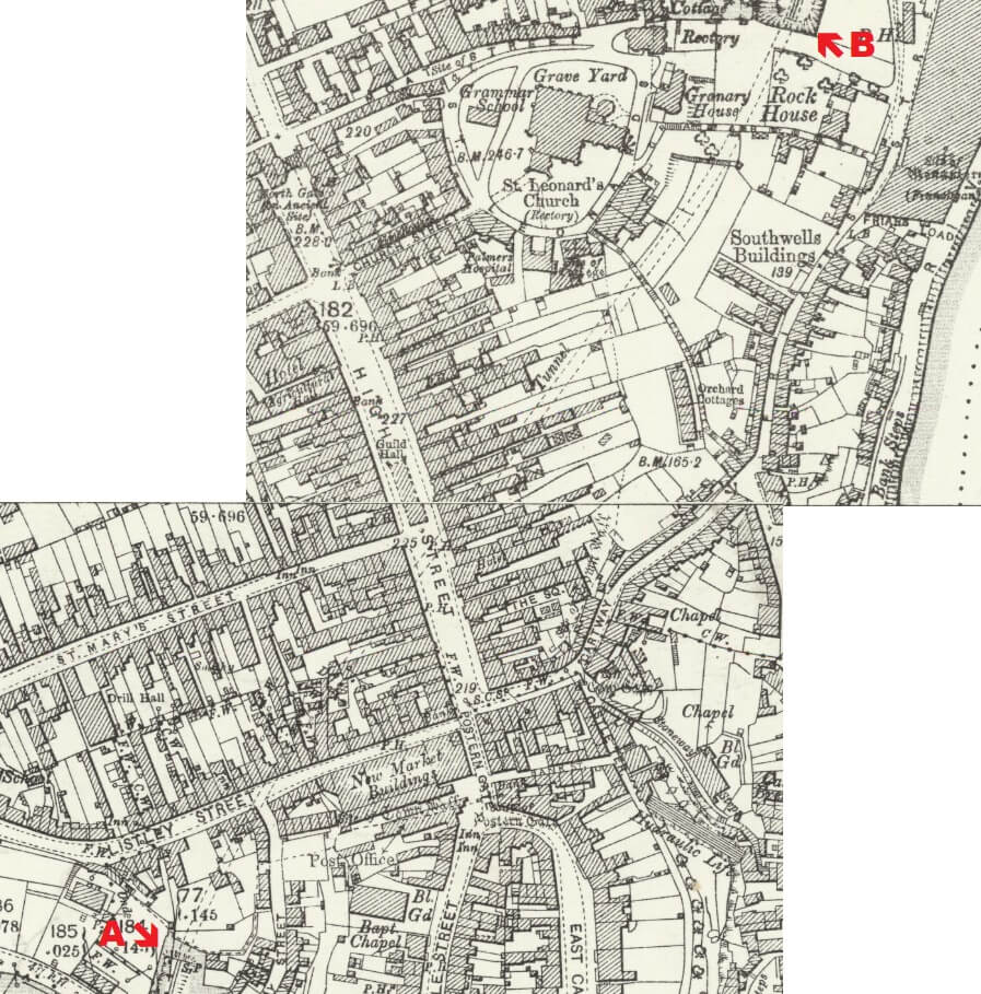
Ordnance Survey 25" to the mile map of Bridgnorth published in 1903, showing the route of the tunnel with it's double curve, and the portals highlighted. The shaft was in the High Street, just south of the Town Hall (Guild Hall).
Reproduced with the permission of the National Library of Scotland for non-commercial, educational and private purposes under the terms of the Creative Commons Attribution-NonCommercial-ShareAlike (CC-BY-NC-SA) licence
Licencing
The copyright holder has given permission for use of this image on the SVRSevern Valley Railway Wiki.
It may not be used for any other purpose without explicit permission from the copyright holder.
If possible, this image should be replaced by one using a free license.
File history
Click on a date/time to view the file as it appeared at that time.
| Date/Time | Thumbnail | Dimensions | User | Comment | |
|---|---|---|---|---|---|
| current | 14:03, 6 November 2019 | | 897 × 909 (169 KB) | Graham Phillips 110 (talk | contribs) | Ordnance Survey 25" to the mile map of Bridgnorth published in 1903, showing the route of the tunnel with it's double curve, and the portals highlighted. The shaft was in the High Street, just south of the Town Hall (Guild Hall).<br> Reproduced with th... |
- You cannot overwrite this file.
File usage
The following page links to this file: